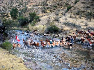
Llama Caravan 2007
Llama Caravan Ethnoarchaeology Project 2007
|
 |
Llama Caravan 2007 - Project Overview
Transport in the Ancient Andes
| Long distance relationships across the mountainous terrain of the Andes are a distinctive attribute of Andean civilization. Ancient states in the Andes, such as the Inka empire, and Wari and Tiwanaku during earlier times, maintained connections through extensive road networks. These roads linked distant regions and served to connect the capital cities based in highland valleys with the Amazon basin and the Pacific littoral, often using large groups of llamas to carry cargo. Archaeologists are piecing together the origins of the caravaning tradition over the last 5000 years. One of the key achievements of Andean peoples in their high altitude landscape was the domestication of members of the camelid genus, a step that facilitated the ensuing escalation of regional trade through llama caravans. |
 |
The importance of llama caravans is widely reported in Spanish colonial documents yet few anthropological studies have closely investigated the caravans in the remaining regions where long-distance caravan travel continues.
Update: My SAA paper describing this project has been posted online
Llama Caravan Transport: A study of mobility with a contemporary Andean salt caravan. Paper presented in the “Nomads Anew” symposium at the 73th Annual Meeting of the Society for American Archaeology, Vancouver, B.C., Canada, March 2008.A poster presented at UC Santa Barbara's Spatial@UCSB inaugural showing the initial analysis results is online here: Estimating Llama Caravan Travel Speeds
This study aims to document the geography of contemporary llama caravan transport in southern Peru by traveling with a llama caravan and using a combination of geospatial technology and interviews to record subjective accounts by native caravan drivers. We began with a controlled physiological study of llama cargo-bearing capacity modeled on recent physiological studies of human porters in Nepal. Subsequently we participated in the acquisition of salt from a quarry in Arequipa, Peru and the transport of this salt for trade to neighboring valleys in Apurimac during a fifteen day round-trip journey.
Our team carefully mapped the caravan route along footpaths using a GPS data logger at a high sampling interval and I am constructing a travel speed model based on the physiological cargo llama profile acquired in our controlled study. This quantitative approach builds on new geographical models of travel in mountainous terrain where routes are mapped not simply through planar map coordinates, but also with a consideration of the effects of slope and other impediments to transport. Geographical models based on human hiking times have been used to estimate travel times between archaeological sites in a geographical information system (GIS) using digital terrain models, however no one has tailored these models to llama caravans in the Andes. Such travel models can be applied to specific distributional studies, such as long distance obsidian exchange, studies of ancient roads, and interaction by Andean polities. Models of distance based on travel time estimates involve many assumptions about ancient travel routes, yet arguably these estimates are closer to the past conceptions of distance than straight-line measures on a government map sheet.
The quantitative model-building is complemented in our study through interviews with caravan drivers in Quechua and in Spanish as we traveled with our informants, and in towns where elderly caravan drivers are found. Our team included two Peruvian anthropologists (Félix Palacios Ríos and Edison Mendoza Martinez, one who is a native Quechua speaker), and two North Americans (Nico Tripcevich and Cheyla Samuelson). Ethnographic record keeping focused on landscape perception, socio-cultural context, economic exchanges, and decision making by caravan drivers. These accounts will further inform a generalized model of distance and geography calibrated to the observations and strategies of llama caravan drivers themselves.
Andean Llama Caravans
Widely described characteristics of llama caravaning tradition in the region
- Facilitate exchange between ecological zones
- Most often llamas (not alpacas) and commonly castrated males
- Estimates for travel: 15-20 km / day , and typically carrying 20-25 kg each on long journeys.
- Approximately 20 animals per herder
- Caravan drivers are typically men on longer journeys
- Ethnohistorically, large trade caravans were organized by powerful leaders
- Households organize long distance caravans today
- Transport of prehispanic cargo was not exclusively borne by camelids. For example, teams of human bearers were widely used by the Inka.
- A market based on supply-and-demand was not found in the Andes in the fifteenth century.
- Exchange values were apparently established by tradition.
Some of the best spatial data came from a data-logger GPS, the iTrek Z1 solar powered MTK GPS data logger. I have conducted some tests of spatial precision on this GPS and I've posted the results online on this website.
Participants
Participants in Llama Caravan 2007 Project
Llameros de Chancara (La Union, Arequipa)
Fidel Cruz Anco
Virginia Gutierrez
Rómulo Cruz
y 15 llamas
Llameros de Laksa (La Union, Arequipa)
Tadeo Ancco
Raúl Ancco
y 13 Llamas
Investigadores:
Participants in Llama Caravan 2007 Project
Llameros de Chancara (La Union, Arequipa)
Fidel Cruz Anco
Virginia Gutierrez
Rómulo Cruz
y 15 llamas
Llameros de Laksa (La Union, Arequipa)
Tadeo Ancco
Raúl Ancco
y 13 Llamas
Investigadores:
Nicholas Tripcevich (Director) - UC Berkeley, USA
Félix Palacios Ríos - Universidad de San Agustin, Arequipa
Edison Mendoza Martinez - Universidad de Huamanga, Ayacucho
Cheyla Samuelson - UC Santa Barbara, USA
Coordinación en Arequipa:
Willy Yepez Alvarez - Arequipa
Support:
This research was supported by a grant from the Heinz Program for Latin American Archaeology (Tripcevich/Yepez Alvarez) and had the institutional support of the Universidad Nacional de San Agustin, Arequipa (Palacios Ríos).
Portraits
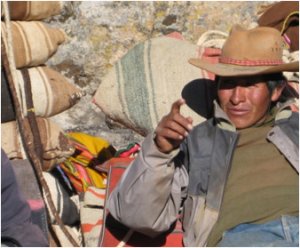 |
Fidel Cruz Anco Chancara, La Union, Arequipa
|
|
Virginia Gutierrez Chancara, La Union, Arequipa
|
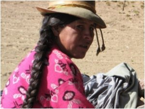 |
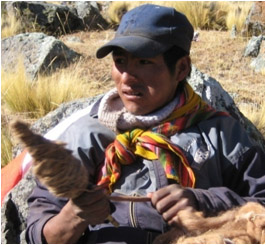 |
Rómulo Cruz Chancara, La Union, Arequipa
|
|
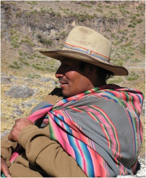
Tadeo Ancco Laksa, La Union, Arequipa
|
 |
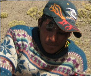 |
Raúl Ancco |
Investigadores
|
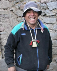
Félix Palacios Ríos Profesor, Etnógrafo
Universidad Nacional de San Agustín Arequipa, Perú
|
 |
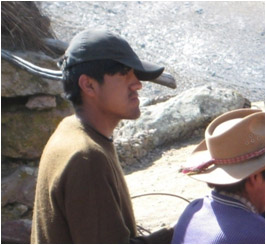 |
Edison Mendoza Martinez |
|
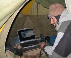
Nicholas Tripcevich Archaeologist, Lab Manager
Archaeological Research Facility UC Berkeley, California, USA
|
 |
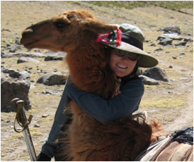 |
Cheyla Samuelson |
|
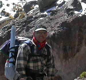
Willy Yepez Arqueólogo
Arequipa, Perú
|
 |
Llama Caravan Video
Llama Purichiq (English)
Llama Purichiq (Español)
Distribuido bajo la licencia Creative Commons (Perú)

Llama Purichiq video (English)
Llama Purichiq video (18 min)
Llama Purichiq (English) from Nico Tripcevich on Vimeo.
Video Credits
"Llama Purichiq" -
Llama caravan driving in southern Peru
Thank you to our friends and informants
Fidel Cruz Anco
Tadeo Ancco Cabana
Virginia Gutiérrez
Rómulo Cruz
Raúl Ancco
Others in Huarhua, Pampamarca, and Calcauso
Video, photography, and field research by
Félix Palacios Ríos
Edison Mendoza Martinez
Cheyla Samuelson
Nicholas Tripcevich
Video edited by: Nicholas Tripcevich 2007
Funded by: A grant from the Howard Heinz Fund for Latin American Archaeology
Project Director: Nicholas Tripcevich
Project Co-director: Willy Yepez Alvarez
Special thanks to
Catalina Borda Cáceres (Hatunhuasi, Cotahuasi)
Augusto Cardona (CIARQ)
Tarek Milleron
Steve Wernke
Justin Jennings
The many others who provided us with support and advice
UC Santa Barbara Anthropology and the Archaeological Research Facility at UC Berkeley
For more information online see www.MapAspects.org
| Released under a Creative Commons Attribution-Noncommercial-Share Alike 3.0 United States License |  |
Llama Purichiq video (Español)
Video Llama Purichiq - Español (18 min)
Llama Purichiq (Español) from Nico Tripcevich on Vimeo.
Créditos del Video
CRÉDITOS DEL VIDEO
Nuestro agradecimiento a nuestros amigos e informantes
Fidel Cruz Anco
Tadeo Ancco Cabana
Virginia Gutiérrez
Rómulo Cruz
Raúl Ancco
Y otros en Huarhua, Pampamarca y Calcauso
Video, fotografías, e investigación de campo realizadas por
Félix Palacios Ríos
Edison Mendoza Martinez
Cheyla Samuelson
Nicholas Tripcevich
Edición de Video por Nicholas Tripcevich 2007
Texto por Félix Palacios Ríos
Financiada por una Beca de Howard Heinz Fund for Latin American Archaeology
Director del Proyecto: Nicholas Tripcevich
Co-director: Willy Yepez Alvarez
Especiales agradecimientos a:
Catalina Borda Cáceres (Hatunhuasi, Cotahuasi)
Augusto Cardona (CIARQ )
Tarek Milleron
Steve Wernke
Justin Jennings
Además proveyeron apoyo y sugerencias
Antropología, UC Santa Barbara
Archaeological Research Facility, UC Berkeley
Mayor información en línea:
Distribuido bajo la licencia Creative Commons (Perú) 
Reconocimiento-No comercial-Compartir bajo la misma licencia 2.5 Perú
Google Map of 2007 Caravan Route
The green line shows the outgoing journey, and the orange line is the return.
You may also download a GoogleEarth KML showing the route of the 2007 caravan. Note: requires GoogleEarth (free) for Mac, Windows, or Linux.
